LiDAR Surveys for Electric Transmission

| |
| Electric Utility |
| Home |
| LiDAR Surveys |
The majority of transmission engineers in North America consider that LiDAR technology offers the most comprehensive and reliable method of surveying both existing and proposed transmission line routes. LiDAR sensors combined with GPS & Inertial Measurement are used in conjunction with Video and Aerial cameras to record a comprehensive swath of digital data across the entire survey route. XP-RS is able to utilize fixed-wing and/or rotary-wing aircraft for its data collection, according to the overall requirements of each project. Similarly, the data developed from each project's sensors is tailored specifically to meet the exact needs of the engineer. While most of the data created by XP-RS is targeted at Deliverables from LiDAR surveys can be composed of any or all of the following:
XP-RS works with some of North America's premier engineering consultants to offer Thermal Analysis of existing transmission lines to determine maximum operating conditions. In conjucntion with these partners, XP-RS is able to offer a field-to-finish engineering solution for Line Rating Projects. Contact us directly to discuss your project requirements. |
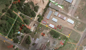
imagery source for both design and permitting applications

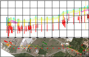
LiDAR derived as-built drawing based on PLS-CADD profile.

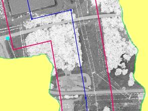
Broad LiDAR coverage for new line route shown as intensity map.
Right-of-way delineated by red lines. Center line shown in blue.

