Remote Sensing
for
Vegetation Mapping

| |
| >>Vegetation Mapping |
| Home |
| Vegetation Mapping for Transmission Lines | ||
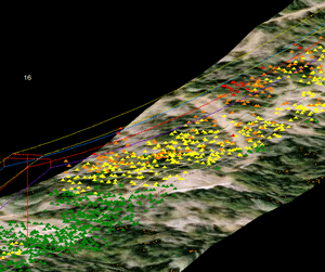
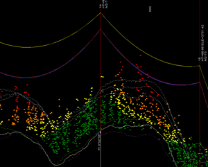
XP-RS is an experienced provider of vegetation mapping data for electric transmission lines. LiDAR data is collected using fixed-wing or rotary wing aircraft and is analyzed using proprietary software or PLS-CADD according to each customer's needs. High resolution Digital Orthophotos and Video are often provided as supplemental data types As a highly accurate 3D mapping technology, LiDAR data has overshadowed the use of orthophotography for vegetation mapping. Mass LiDAR data is classified to derive conductor locations, structures & attachment points, bare earth and vegetation layers. This data is then employed to determine vegetation growth clearances and the location of danger trees according to the needs of the client. |
 |
|
The most simple analysis involves determining clearances to the as-surveyed conductor position. More complex analysis involves modeling a range of load-cases based on the original design parameters for line. For comprehensive analysis finite element analysis is used to model clearances to conductor loadings which are based on the as-surveyed sag/tension. The clearance analysis data delivered by XP-RS to its clients is highly tuned to individual needs and can be used to determine vegetation risk and trimming schedules in an auditable format that satisfies compliance authorities. Contact us directly to discuss your vegetation mapping project requirements. |
|

