Remote Sensing
for
Gas Pipeline Applications

| |
| >>Gas Utility |
| Home |
| Gas Pipeline Solutions |
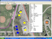
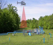
XP-RS has significant experience in acquiring and utilizing geospatial data for gas pipeline applications such as Integrity Management Programs (IMP) and Engineering Design Projects. Data is developed and delivered in formats suitable for GIS environments such as SmallWorld and ESRI products. Engineering data can be delivered as either 2D or 3D AutoCAD or MicroStation drawings, or can be formatted for use with engineering design software. XP-RS uses a range of airborne remote sensing technologies to provide the best balance between price and performance according to the customer's requirements. For example data acquisition for IMP identified site update surveys can be accomplished using either conventional orthophotography or with high resolution stabilized video. In contrast, the higher accuracy requirements for an engineering design project will almost always require the use of LiDAR technology. Select the links left or right to learn more or contact us directly to discuss your pipeline project requirements.
|
| IMP Surveys |  |
|---|---|
| LiDAR Surveys |  |
| Leak Detection |  |
